Clinton Bailey
The College of Wooster
Department of Geology
*This material is based upon work supported by the National Science Foundation under Grant No. 9910805. Any opinions, findings, and conclusions or recommendations expressed in this material are those of the author and do not necessarily reflect the views of the National Science Foundation.
<– Return to main pages list
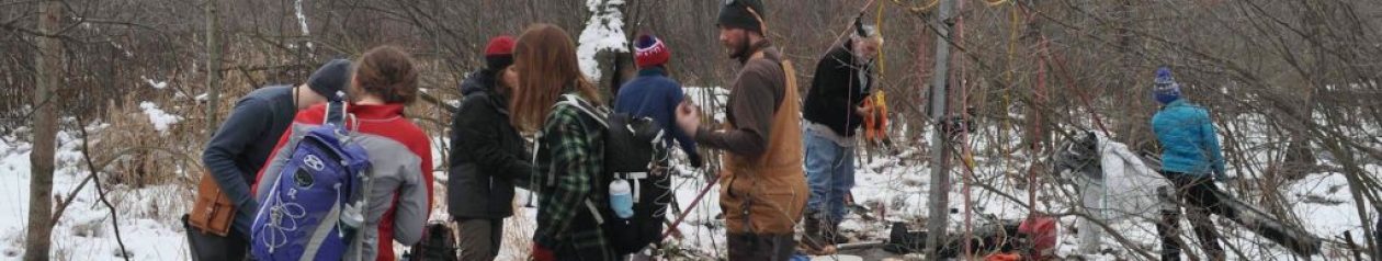
In the summer of 2001, I had the privilege of traveling with Dr. Greg Wiles and Dr. Parker Calkin to study the Columbia Glacier in Alaska. This website is a brief report including a description of the trip, its purpose, and a summary of the laboratory work that is an ongoing part of this project.
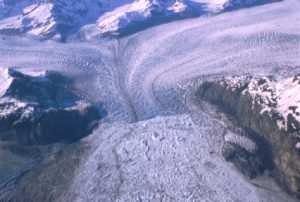
Today glaciers cover an impressive 10% of the world’s landmass. In the United States alone, glaciers spread over 75,000 square kilometers of earth. Most of the glaciers found in the U.S., such as the Columbia Glacier (Fig.1), are located in Alaska.
There are many important reasons to study glaciers. One popular reason is to establish a link between glacial melting and global warming. A glacier’s behavior is dependent upon two variables, climate and precipitation. Today glaciers from the Himalayas to Africa to Alaska are retreating dramatically, while at the same time, worldwide precipitation has remained constant over the past few decades. Given the undeniable link between glacial activity and climate, the fact that glaciers are retreating around the world (almost without exception) makes an interesting case for global warming.
The purpose of the study of Columbia Glacier in 2001 was to extend an existing tree ring chronology for the Prince William Sound from 1100 A.D. to 700 A.D. At the same time, samples from many sites along the walls of the Columbia Bay will be added to strengthen the master chronology already in use. These samples will provide a better understanding of the behavior of the Columbia Glacier over the past 2000 years as well as a year by year record of climate in the area over that span. A third reason for this summer’s study was to collect more evidence for a climate and precipitation link between Alaska and the rest of the United States called the Pacific Decadal Oscillation.
For more information about glaciers, the National Snow and Ice Data Center has a page all about them.
Read more about the Pacific Decadal Oscillation here.
Comments and suggestions are welcome and can be mailed to clinton_bailey@hotmail.com.
Related pages
- Dendroclimatology of the Columbia Bay Region, Prince William Sound, Alaska by Aaron Shear
- Late Holocene Glacial Stratigraphy of Columbia Bay Alaska: Extending the Record by Matthew Beckwith-Laube
- A Thousand Year History of Glacial Change from Columbia Glacier, Prince William Sound, Alaska by Kirk Lapham
- Calving Glaciers with an Emphasis on Columbia Glacier, Prince William Sound by Megan Kennedy